Chapter 4
Lesson 2
This lesson examines:
- Aeronautical maps
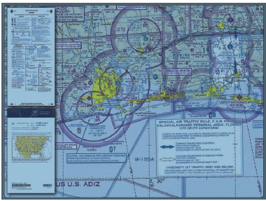
This chapter provides an introduction to aeronautical charts. An aeronautical chart is the road map for a pilot flying under VFR. The chart provides information that allows pilots to track their position and provides available information that enhances safety.
For sUAS, only a portion of the information is relevant, however, the part 107 exam will ask questions regarding your knowledge of 14 CFR parts 61 and 91. Included in this is aeronautical maps -or- sectional charts.
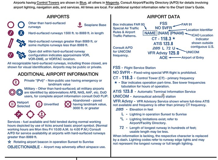
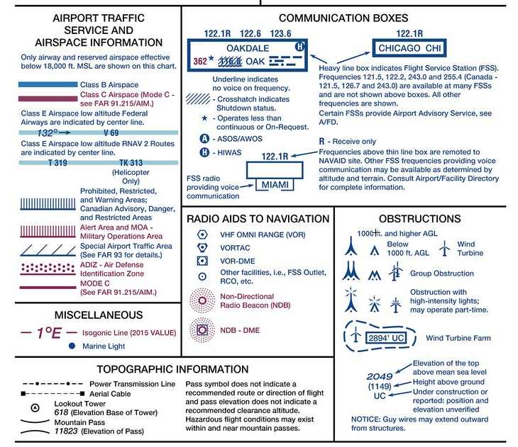
The charts provide an abundance of information, including airport data, navigational aids, airspace, and topography. Below is an excerpt from the legend of a sectional chart. By referring to the chart legend, a pilot can interpret most of the information on the chart. A pilot should also check the chart for other legend information, which includes air traffic control (ATC) frequencies and information on airspace. These charts are revised semiannually except for some areas outside the conterminous United States where they are revised annually.
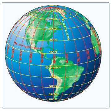
Any specific geographical point can be located by reference to its longitude and latitude. Washington, D.C., for example, is approximately 39° N latitude, 77° W longitude. Chicago is approximately 42° N latitude, 88° W longitude.
Time Zones - The meridians are also useful for designating time zones. A day is defined as the time required for the Earth to make one complete rotation of 360°. Since the day is divided into 24 hours, the Earth revolves at the rate of 15° an hour. Noon is the time when the sun is directly above a meridian; to the west of that meridian is morning, to the east is afternoon.
The standard practice is to establish a time zone for each 15° of longitude. This makes a difference of exactly 1 hour 75 between each zone. In the conterminous United States, there are four time zones. The time zones are Eastern (75°), Central (90°), Mountain (105°), and Pacific (120°). The dividing lines are somewhat irregular because communities near the boundaries often find it more convenient to use time 5°° designations of neighboring communities or trade centers.
Because a pilot may cross several time zones during a flight, a standard time system has been adopted. It is called Universal Coordinated Time (UTC) and is often referred to as Zulu time. UTC is the time at the 0° line of longitude which passes through Greenwich, England. All of the time zones around the world are based on this reference. To convert to this time, a pilot should do the following:
| Eastern Standard Time | Add 5 hours |
| Central Standard Time | Add 6 hours |
| Mountain Standard Time | Add 7 hours |
| Pacific Standard Time | Add 8 hours |
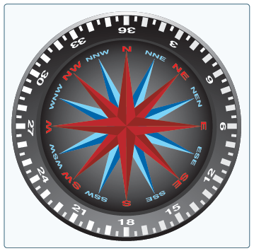
Measurement of Direction - By using the meridians, direction from one point to another can be measured in degrees, in a clockwise direction from true north. To indicate a course to be followed in flight, draw a line on the chart from the point of departure to the destination and measure the angle that this line forms with a meridian. Direction is expressed in degrees, as shown by the compass rose below:
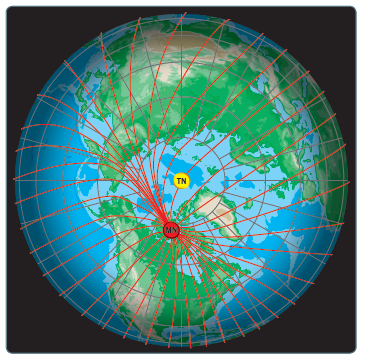
The north magnetic pole is located close to 71° N latitude, 96° W longitude and is about 1,300 miles from the geographic or true north pole, as indicated below:
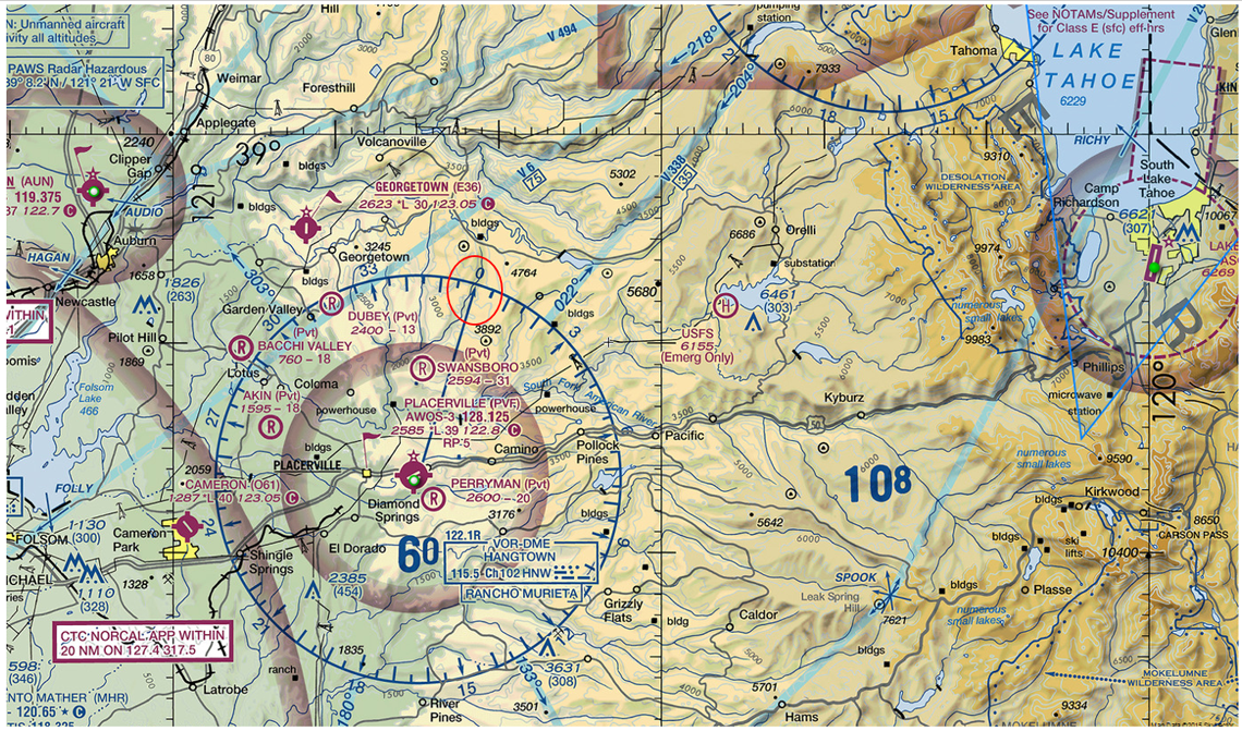
Below, the arrow circled in red points to magnetic north:
Below, are sample chart legends
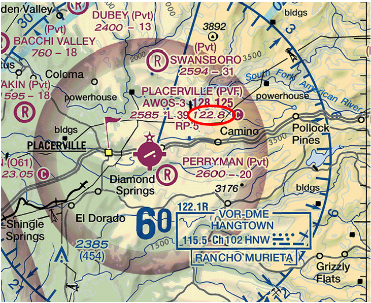
Below, the text circled in red is the tower frequency:
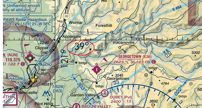
Below, the number circled in red is the latitude:
Below, the number circled in red is the longitude:
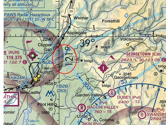
Logitude numbers get bigger to the left while latitude numbers get bigger to the top:
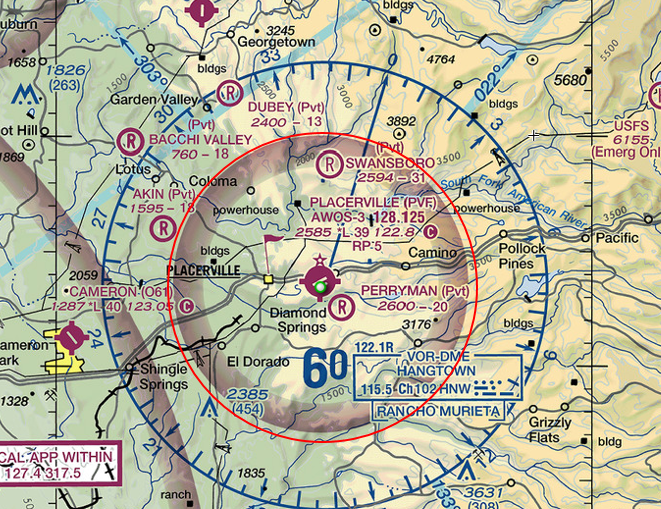
Below, the magenta circled in red is the 5 mile radius of the airport. You must have a COA or permission from the tower (if one exists) prior to flying within this zone:
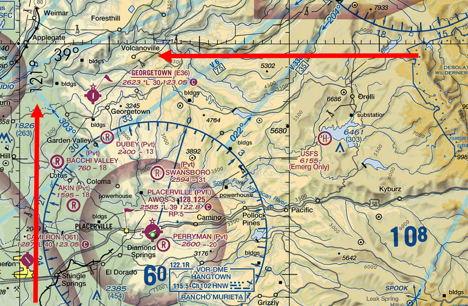
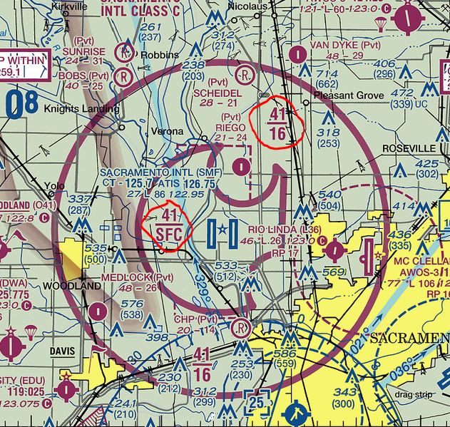
Below, sectionals show the airspace elevations (add two 0's at the end). 41/SFC means the upper limit of that ring is 4,100 feet and the lower limit is the surface. 41/16 means the upper limit of that ring is 4,100 feet and the lower limit is 1,600 feet. Remember, sUAV's have a ceiling of 400 feet, so you could fly an sUAV in the outer ring, and if within 5 miles of an airport the operator of the aircraft must obtain permission from the airport operator and the airport air traffic control tower (when an air traffic facility is located at the airport) prior to the operation. Airports in class D airspace (towered) do not have this marking, class D airspace is surface to 2,500 feet and do not have solid magenta rings. Airports in class E airspace (non towered) unless designated at a lower altitude, Class E airspace begins at 14,500 feet and may not have solid or feathered magenta rings. (see Cameron park and Georgetown above). You still have to stay 5 miles away from non towered airports unless you get prior permission from the ATC. These measurements are always in MSL.
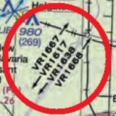
Below, this is a Military Training Route from 1,500 feet AGL. It is extremely important to know this so you can expect low-flying military helicopters flying this route. Some of which may be at 400ft or below. Here is what the AIM says: “(a) MTRs with no segment above 1,500 feet AGL must be identified by four number characters; e.g., IR1206, VR1207. (b) MTRs that include one or more segments above 1,500 feet AGL must be identified by three number characters; e.g., IR206, VR207.” They can ALWAYS be flying in your airspace.
Please visit SkyVector and check out your area and look at the map
This lesson examined Aeronautical maps.
In summary, know how to read the legend and find latitude and logitude coordinates.
The next lesson describes airspace.
Practice Questions using SkyVector
1. What body of water is at N40°16' W121°11'?
Mountain Meadows ReservoirBucks Lake
Lake Almanor
2. What should you look out for at N38°14' W122°5.65'
BalloonsMilitary Base
Windmills
Next Chapter